| Coordinates WGS84 | 11°19'S, 130°40'E -11.32, 130.66 |
SAM_A_47142
Title: A message stick sent to the Red Ochre totemic group, indicating that the final pukamuni ceremonies would take place in about twenty days, Tiwi Islands
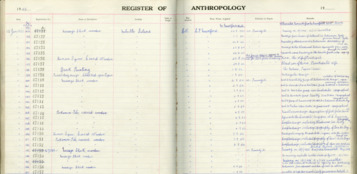
Description: The purunkita (Fig. 5A) belonged to the totemic red-ochre group at Numanira, west of Karslake Island. The left-hand band of short transverse bars at 'a', represents the lines of coloured ochres in the sands of the sea-shore; the dots on the next band, 'b', to the right, are the oysters on the rocks at Numanira; band 'c' indicates the reefs of red and yellow ochres covered at high tide; 'd' is the motor road along the cliff on the mainland opposite Karslake Island, and 'e', the trees on the shore of Karslake Island, opposite Numanira. (103) Register says: "Message stick, wooden. Locality: Melville Island. How acquired: Coll. From Whom acquired: C. P. Mountford. Mr Mountford's date: 3.9.1954. n.n. punundjiti. Abbreviated remarks from Mr. Mountford's note books: Sent to Red Ochre group near Carslake Id. Topographical"
Message: Mountford (1958, p24): "Toward the end of this series of ilanias, the "workers" announced that they had finished cutting the poles. The leader, the alouwia, hearing this, gave permission for the poles to be "cooked", i.e., burnt in a fire of blazing boughs, to provide a black ground on which to paint the designs. The leader also ordered that the purunkitas (message sticks, Figs. 5, 6, 7), be sent out to the various totemic groups. These sticks intimated that the final pukamuni ceremonies would take place in about twenty days." Mountford (1958, p103) "The left-hand band of short transverse bars at 'a', represents the lines of coloured ochres in the sands of the sea-shore; the dots on the next band, 'b', to the right, are the oysters on the rocks at Numanira; band 'c' indicates the reefs of red and yellow ochres covered at high tide; 'd' is the motor road along the cliff on the mainland opposite Karslake Island, and 'e', the trees on the shore of Karslake Island, opposite Numanira. "
Creator of Object: totemic red-ochre group
Date Created: 1954
Notes on date created: Year of the National Geographic Expedition to Melville Island
Item type: message stick in a collection
Subtype: traditional
State/Territory: NT
Linguistic area 1: Chirila: Tiwi Austlang: N20 - Tiwi Glottolog: tiwi1244
Notes on linguistic areas: Tiwi is the affiliation provided by the South Australian Museum in the field "Name: (Cultural Associations) LANGUAGE" The message stick is associated with Numanira, west of Karslake Island. This placename doesn't appear in sources outside of Mountford's. However, Karslake is part of the Tiwi islands, of which the language is Tiwi.
Cultural region: TopEnd_tiwi
Term for 'message stick' (or related) in language: purunkita
Source types: museum collection
Date collected: Date registered: 15. Jan 1955
Institution/Holder file: The South Australian Museum object identifier: A-47142
Collector: Collected by: Mountford, Charles P.
Coordinates: 11°19'15.600000"S,130°39'40.201200"E (-11.321, 130.661167)
Media copyright: The South Australian Museum
Notes on coordinates: Absolute coordinates for Karslake Island
Notes: This has been merged (CPM1958P103F5A previously) AR: Checked against original SAM register. No new information added.
Media Files:
Data Entry: Julia Bespamyatnykh, Piers Kelly, Alexandra Roginski

