| Coordinates WGS84 | 24°05'S, 115°54'E -24.08, 115.90 |
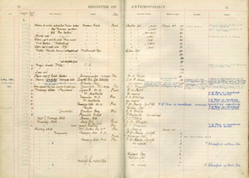
SAM_A_3819
Title: A message stick from Western Australia held in the South Australian Museum
Description: Message stick "bamboora" from the South Australian Museum
Date Created: 1902
Notes on date created: terminus ante quem
Item type: message stick in a collection
State/Territory: WA
Linguistic area 1: Chirila: Warriyangga Austlang: W22 - Warriyangga Glottolog: wari1262
Notes on linguistic areas: The message stick is associated with Lyons River, Western Australia. PK: For Lyon's river the suspects are, the following, with info re location taken from Austlang: Malgaru ("East of Kennedy Range and in the hills east of Lyons River from Gascoyne Junction north to near Minnie Creek; at Eudamullah; south to near Fossil Hill (Tindale 1974)" Watjarri ("the country originally inhabited by the Wajarri appears to have extended from between the Wooramel and Gascoyne Rivers south to between the Murchison River and the Geraldton-Mt. Magnet road; in the west it approached the coastal highway and in the east it extended to around Mileura Station (Marmion 1996:2). North to the hills overlooking the head of the Lyons River, Teano Range, Mount Isabella, Waldburg Range; on upper Gascoyne River west of Three Rivers; at Erivilla and Milgun; south to Cheangwa and the Roderick and upper Sanford rivers (Tindale 1974). ... along the upper reaches of the Murchison river, from around Yallalong Station in the west, to near Meekatharra in the east, from north of Mt Augustus, to south of Talarang Peak (sic, gazetted as Tallering Peak) (Mackman 2011:231). ") Yingkarta: ("Dench (1979) and O'Grady, Voegelin and Voegelin (1966) say the language has a northern and southern dialect. Austin names the dialects as Manthi and Thirrily. Tindale locates Mandi (Manthi) at Carnarvon, on the lower Gascoyne River from Doorawarrah to the sea, south to near Grey Point, north only to the southern part of Boolathanna. Tindale locates Tedei (Thirrily) at the eastern coast of Shark Bay and valley of the Wooramal River from the coast north of Yarringa, north only to Pimbie, Carey Downs, and the south of Towrana (WA Handbook). the Yingkarta (Inggarda) territory is far too large and extends east of where it should be - the limit was Gascoyne Junction and the Lyons River (Austin in Sutton 1995:97). The territory occupied by the Yingakarta people extended from the coast at the northern end of Shark Bay between the Gascoyne and Wooramel rivers, along the rivers inland to Red Hill and Gascoyne Junction (Dench 1998:5).") Warriyangga: ("Upper Lyons River, also Gifford and Minnie creeks; on Minnie Creek Station, at Edmund and the eastern side of Maroonah (Tindale 1974). Malgaru: East of Kennedy Range and in the hills east of Lyons River from Gascoyne Junction north to near Minnie Creek; at Eudamullah; south to near Fossil Hill (Tindale 1974). Warriyangka country was from Edmund south along the Lyons River, not nearly as far north as Davis (1993) indicates (Austin in Sutton 1995:97).") On the balance of probabilities, Warriyanga is the best bet for '"Lyons' River". Also compare lexical item.
Term for 'message stick' (or related) in language: pampura ("bamboora")
Source types: museum collection
Date collected: Acquisition date: 1902 Date registered: 1911-1918
Institution/Holder file: The South Australian Museum object identifier: A-3819
Collector: Purchased from: Birt, G.H.
Coordinates: 24°05'3.598800"S,115°54'4.899600"E (-24.084333, 115.901361)
Media copyright: The South Australian Museum
Notes on coordinates: Spot on Lyon’s situated roughly between the named East and West parts of it.
Notes: AR: Checked against SAM register. No new information.
Media Files:
Data Entry: Olena Tykhostup, Piers Kelly, Alexandra Roginski
