| Coordinates WGS84 | 31°29'S, 127°49'E -31.48, 127.82 |
CPM1938P125F6
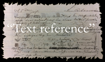
Title: Sketch of a message stick from C. Mountford's "Aboriginal message sticks" (1938)
Description: Sketch of message stick on p. 125 of “Aboriginal message sticks” by C. Mountford
Message: Figure 6 was obtained from a locality on the Trans-Australian Railway Line approximately on the border of South and Western Australia. Three tribal groups are indicated: one from Laverton, a town some 200 miles north, one belonging to the Muramul tribe, and the other, the people whose territory is adjacent to the Karonie Mission Station which is situated adjacent to the railway line and some 60 miles east from Kalgoorlie. The meaning obtained from the sender of the stick, is as follows: -B, figure 7, is the sender of the stick, and A the Karonie railway dam. (The use of the U-shaped symbol for a dam is notheworthy). The line of dots, E, represents the aborigines who reside permanently at the Mission Station; line D, the end of which terminates at one limb of A, those who sit down along railway line," i.e., camp beside railway line. The group of natives from Laverton is indicated by the line C, while G refers to Muramul tribe, which sometimes visits the Karonie Mission Station. M symbolizes the above mission." (p. 123-124)
Date Created: 1938
Notes on date created: terminus ante quem
Item type: image of a message stick (artefact missing)
Subtype: traditional
State/Territory: SA
Linguistic area 1: Chirila: Mirniny Austlang: A9 - Mirning
Notes on linguistic areas: The message stick is associated with "Trans-Australian Railway Line, approximately on the border of South and Western Australia" (p. 125) Mirniny [Chirila map] is probably where the stick was created. This is most likely in the vicinity of Deakin on the T.A.R ["Figure 6 was obtained from a locality on the Trans-Australian Railway Line approximately on the border of South and Western Australia.]. The only T.A.R. stop on this border is Deakin. However, there are three more groups actually depicted on the stick: -Laverton 200 miles north of Trans-Australian railway: the best approximation is Tjalkanti (Chirila) -Muramul tribe: this can not be identified -Karonie Mission Station, territory adjacent
Semantic domains: sd_person_group, sd_person_recipient, sd_person_sender, sd_place_dam, sd_place_mission
Sources:
Collector: Mr. Allen Musgrave
Coordinates: 31°28'53.619600"S,127°49'12.014400"E (-31.481561, 127.820004)
Notes on coordinates: Chirial entroid coordinates for Mirniny
URL source 1: https://archive.org/stream/TransactionsRoy62Roya#page/123/
Media Files:
Data Entry: Olena Tykhostup, Piers Kelly


