| Coordinates WGS84 | 31°24'S, 148°20'E -31.39, 148.34 |
AMus_E032198
Title: A message stick sent from Goodooga to Brewarra in the Australian Museum
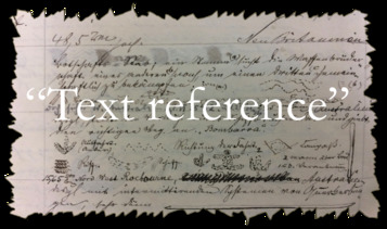
Description: Sketch of message stick on p. 293 of "Message-sticks used by the Aborigines of Australia" by Robert Hamilton Mathews
Message: A stick sent by Nanee (a) [...] to Boomee, Murri Opossum (b). [...] Kubbi (c), one of the head-men of the Culgoa tribe, carried it from Goodooga to Tatalla, on the Culgoa river, where he handed it over to Noondooayah, Murri Opossum (d), one of the Cuttaburra tribe [...] with the following oral message: Nanee asks Boomee to muster his tribe and bring them to Tatalla, on the Culgoa river, to hold a big corroboree." (e) is the road the Cuttaburra blacks will travel to Tatalla; (f) is the track the Culgoa blacks will use in going to the same place; (g) is the track to the corroboree ground; if the Cuttaburra tribe arrive at Tatalla after the Culgoa tribe, they will see by the footmarks of the latter where to turn off the road and will follow the tracks to the corroboree ground; (h) is the camp of the Cattaburra tribe, with Boomee standing beside it; (i) is the camp of the Culgoa tribe, alongside of which Nanee is standing, and (j) is the corroboree ground, with the track leading to it from the main road." (p.297)
Creator of Object: Sender: "Nanee, one of the head-men of the Culgoa tribe" Recipient: "Boomee, Murri Opossum, one of the head-men of the Cut-taburra tribe" (p.296)
Date Created: 1897
Notes on date created: terminus ante quem
Item type: message stick in a collection
Subtype: traditional
State/Territory: NSW
Linguistic area 1: Chirila: Muruwari Austlang: D32 - MURUWARI / MURRAWARRI Glottolog: muru1266
Notes on linguistic areas: The message stick is associated with the "Goodooga, on the Bokhara river, New South Wales, sent to Brewarra, on the Cuttaburra river, New South Wales" Goodooga is in the Muruwari-speaking region and Brewarra is at 31°23'34.5"S, 148°20'14.1"E on the edge of the Wiradjuri area
Semantic domains: sd_ceremony, sd_journey_route, sd_person, sd_place_camp, sd_place_lawground, sd_request_invitation_ceremony, sd_track
Sources:
Institution/Holder file: The Australian Museum object identifier: E032198
Collector: I obtained the message-sticks and all the details respecting them from Mr James E. Miller, a police trooper stationed at Goodooga township. He has been traveling through that district in the discharge of his official duties for some years past and is well acquainted with the numerous aboriginal population, who still preserve their ancient customs. (p.292)
Coordinates: 31°23'34.501200"S,148°20'14.100000"E (-31.392917, 148.33725)
Media copyright: The Australian Museum
Notes on coordinates: Absolute coordinates for Brewarra
URL institution: http://nla.gov.au/nla.obj-52785381
Notes: Previous ID: RHM1897P292F10 Here is the journey of the object. Mathews writes: "It was dispatched from Goodooga, on the Bokhara river, to Brewarra, on the Cuttaburra River, both places being in New South Wales. Kubbi (c), one of the head-men of the Culgoa tribe, carried it from Goodooga to Tatalla [Tatala], on the Cul-[297]goa river, where he handed it over to Noondooayah [...] Noondooayah then carried the stick from Tatalla to Brewarra and handed it to Boomee, with the following orsl message...." (Mathews 1897). It appears that Brewarra was a station on the Cuttuburra and in the vicinity of Brewarrina, per this article in Trove: http://nla.gov.au/nla.news-page147903 This article (http://nla.gov.au/nla.news-article162818950) says "Leaving Brindingabba, we come to the property of the great millionaire, Mr. James Tyson, coming first to his Brewarra station, having first watered our cattle at the well-known Muckageeroo waterhole, which is one of the principal holes on the Cuttaburra Creek. The extent of Mr. Tyson's holdings will be understood when I tell my readers that the cattle can travel 100 miles without being blocked by a fence. I believe prior to the drought some 90,000 head of cattle were on the run, which includes Tinenburra, Brewarra, Maianoa. Munjourie, and other out-stations; horses, too, are numbered by the thousand. Another article (http://nla.gov.au/nla.news-article158400844) places it "on the Lower Cuttaburra, joining the Queensland border fence". Somebody online says that Brewarra Station was at Yantabulla https://www.tapatalk.com/groups/australiansurnamesgroup/outback-burial-place-t6838.html, and various articles on Trove confirm this proximity However there are at least two other Brewarra stations. One up in the northern part of Queensland, per this article (http://nla.gov.au/nla.news-article39445854) "Crossing the Tate the following morning I headed for Brewarra Station, the property of Mr. Dixon. The head station is situated on the Lynd River, about 12 miles from the Telegraph Station" There is another 'Brewarra Station' described as being 20 miles from Narromine: http://nla.gov.au/nla.news-article131341131 but that is not on the Cuttuburra There is a Brewarra homestead but it's much futher south (at 31°24'00.0"S 148°19'60.0"E). Coordinates for Goodooga: 29°06'54.0"S 147°27'04.0"E Coordinates for Tatala (per NSW Geographical Names Board): 29°07'53.6"S, 146°59'01.5"E Coordinates for Yantabulla: 29°20'53.9"S 145°00'05.0"E Coordinates for Brewarrina: 29°57'45.0"S 146°51'40.0"E
Media Files:
Data Entry: Olena Tykhostup, Piers Kelly


